Cruising and trip planning · Bahamas
Fort Lauderdale to Bimini: A Worked Trip Plan
Explore a flexible Bimini example and adjust sample speed, fuel and reserve assumptions to compare planning estimates.
A flexible example for an experienced coastal skipper
This example organizes a first Bahamas visit around a Florida staging day, an outbound movement, two local days and a return movement. Two additional days remain uncommitted for weather or a changed plan. It is a constructed itinerary, not an endorsed departure window.
Make these inputs your own
- Vessel, draft, operating limits, season, departure date and crew capability need your review.
- Enter planning speed in knots and total-vessel consumption in US gal/h. Use the sample calculator below to explore these assumptions; review actual performance for your boat.
- Review current charts and actual approach geometry; destination markers do not define the passage.
- Confirm usable fuel, idle/auxiliary allowances, overnight arrangements, customs and communications.
Ready to build your own version?
Use FPW to create your own route and adjust the stops, mileage, speed and timing for your boat.
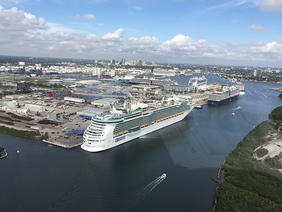

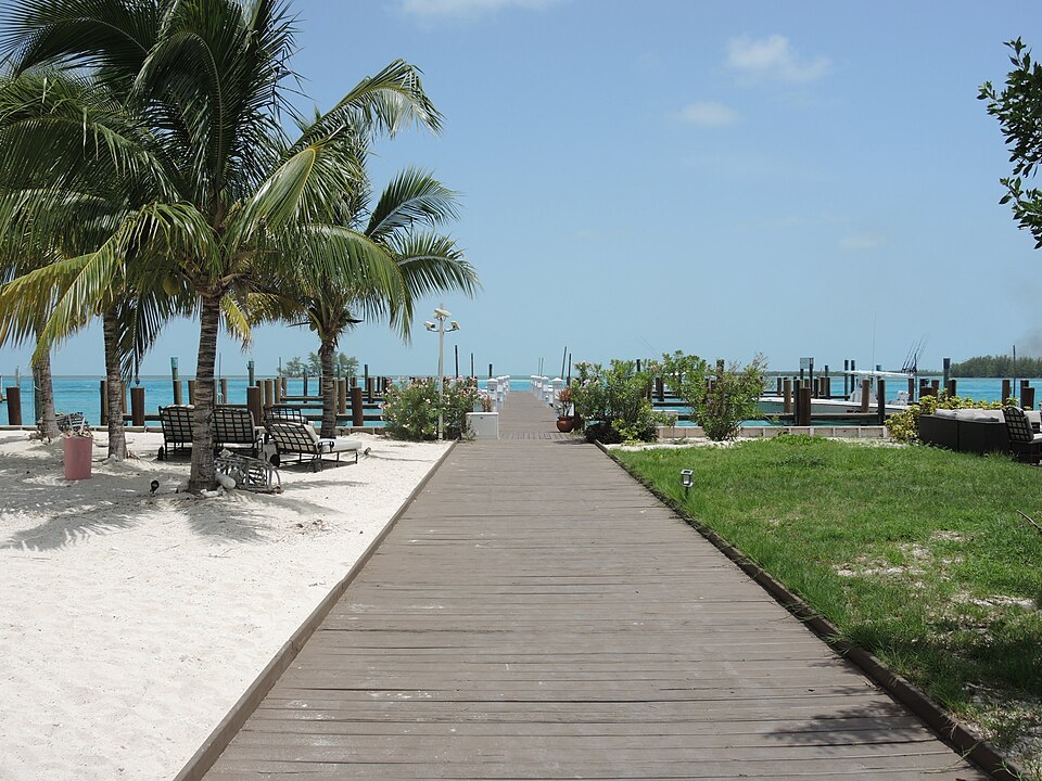

Explore the sample’s time and fuel assumptions
This example keeps the sample planning mileage fixed at 50.3 NM outbound and 50.3 NM return, 100.6 NM total. Change the four assumptions below to see how the example estimates respond.
Sample planning assumptions
Sample estimates for 100.6 NM
- Movement time
- Base underway fuel
- Added reserve
- Total estimated fuel requirement
- Usable fuel minus estimated requirement
These are planning estimates, not a range assurance or a departure decision. The separate 60 NM-per-leg worksheet below keeps its original illustrative assumptions.
Use your own boat's speed and fuel burn to run the numbers.
Open the Fuel CalculatorKnow what each point represents
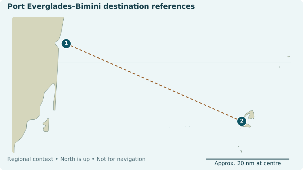
On a narrow screen, scroll the map horizontally. Open the full port everglades and bimini reference map. The table below provides the same locations.
| Stop | Published coordinates & role | Source and review task |
|---|---|---|
| 1 · Port Everglades lighted buoy PE — planning reference | 26°05′30″N., 80°04′46″W.maritime reference. Datum: unspecified in cited passage. | NOAA U.S. Coast Pilot 4, chapter 10 Rounded NOAA reference published November 1, 2026; it replaces the earlier, more precise Light List value. This is not a berth or anchorage. Check current notices and review staging/harbor movements separately. |
| 2 · Brown’s Marina, Bimini — candidate destination reference | 25°43’19.9″N – 79°17’53.8″Wmarina destination reference. Datum: unspecified by source. | Brown’s Marina Brown’s is a candidate destination, not a berth reservation or offshore approach waypoint. The source does not state coordinate datum or revision. Ask the marina about current approach conditions and review the intended path. |
The selected Bimini candidate is Brown’s Marina, based on its first-party published location. This replaces the earlier Big Game Club berth candidate in this example. Brown’s page describes changing harbor sandbars and directs visitors to contact the marina. A published marina location does not validate the harbor approach.
| Leg | Planning mileage | Source/method and review |
|---|---|---|
| 1 → 2 · Outbound: Port Everglades → Brown’s Marina | 50.3 NM estimatesource reported estimate | Example route distance — review for your trip. Owner-supplied planning estimate from Port Everglades Lighted Buoy PE to Brown’s Marina. Measurement method, chart source and date unspecified. No approach geometry or independent navigation verification is supplied.Review for your trip. The map connection is schematic. |
| 2 → 1 · Return: Brown’s Marina → Port Everglades | 50.3 NM estimatesource reported estimate | Example route distance — review for your trip. Owner-supplied planning estimate from Brown’s Marina to Port Everglades Lighted Buoy PE along the same example path in reverse. Measurement method, chart source and date unspecified. No approach geometry or independent navigation verification is supplied.Review for your trip. The map connection is schematic. |
Example route distance total: 100.6 NM — review for your trip. The distances are owner-supplied planning estimates, not independently verified route lengths. The return uses the same example path in reverse. Measurement method, chart source and date are unspecified. Review each leg for an actual trip.
The sample calculator above uses this 100.6 NM total. At the worksheet’s illustrative 20 kn and 18 US gal/h, these 100.6 NM produce 5 h 02 min, 90.5 US gal base consumption and 108.6 US gal including 20% added reserve. These initial operating assumptions are illustrative; review actual performance for your boat.
Big Game Club’s 47.6 nm published approach comparison describes different references and links to a chart dated 2009. It is neither a current berth-to-berth validation nor a distance for the PE buoy–Brown’s Marina pair. It stays separate from both the sample legs and the illustrative worksheet.
Review mileage for the route you intend to travel
The sample uses 50.3 NM outbound and 50.3 NM return, labeled “Example route distance — review for your trip.” These owner-supplied estimates have no documented measurement method, chart source or measurement date. A straight line between the reference points, the marina’s Miami distance and the separate 60 nm worksheet are not mileage sources for these legs.
- Define the movement. Check the example’s endpoints against your intended departure and arrival. The PE buoy reference excludes travel from your Florida berth. Include any staging or harbor movements, and account for changed endpoints before measuring.
- Measure a reviewed water path. In current charting or route-planning tools, plot the passage and harbor approach your skipper intends to use. Check source dates, depth/draft constraints and local information. Record that tool’s route-distance result in nautical miles; do not measure this page’s dashed schematic line. FPW does not independently validate the plotted path.
- Review the resulting estimates. Use your actual distance, speed, consumption and reserve assumptions when planning your own trip. You can use FPW’s Route Generator to build your own Bahamas route and draw its geometry independently of this guide’s sample.
Review the affected leg again after changing endpoints, mileage or geometry. The sample mileage does not create or validate a navigable map line.
Illustrative time and fuel worksheet
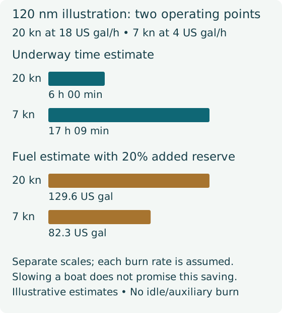
Separate illustrative calculation using 60 NM legs. This arithmetic example assumes 60.0 nm for each movement. These distances are not sourced route lengths for the example’s endpoints.
Explicit assumptions
- Speed: 20 kn; total-vessel underway consumption: 18 US gal/h.
- Nominal fuel aboard: 200 US gal; unusable: 10 US gal; usable aboard: 190.0 US gal.
- Idle and auxiliary allowance: 0 US gal in this illustration; add the actual allowance when applicable.
- Reserve: 20% added to base consumption, applied once.
- One knot is one nautical mile per hour. One nautical mile is 1,852 metres.
The calculation
Movement time = planning distance ÷ speed.
Underway fuel = movement time × total-vessel consumption.
Reserve = base consumption × 20%.
Required quantity = base consumption + reserve.
Calculate at full precision, then display distance and fuel to one decimal and time to the nearest minute. These results are estimates and do not decide whether a crossing is safe.
| Movement | Distance estimate | Time estimate | Fuel estimate |
|---|---|---|---|
| Outbound illustration | 60.0 nm | 3 h 00 min | 54.0 US gal |
| Return illustration | 60.0 nm | 3 h 00 min | 54.0 US gal |
| Local days | Notes only; no boat excursion or fuel consumption assumed | ||
| Movement total estimate | 120.0 nm | 6 h 00 min | 108.0 US gal |
Reserve estimate: 108.0 × 20% = 21.6 US gal.
Estimated required departure quantity: 108.0 + 21.6 = 129.6 US gal.
Usable fuel above that calculation: 190.0 − 129.6 = 60.4 US gal.
The percentage is not also subtracted from capacity. These results do not include a fuel-stop assumption or an assurance of range in actual conditions.
A slower operating-point comparison
Independently assume 7 kn and 4 US gal/h for the same 120.0 illustrative nm. The resulting estimate is 17 h 09 min, 68.6 US gal base burn and 82.3 US gal including reserve. The consumption rate is an assumption for that operating point, not a claim about the effect of slowing every boat.
Keep the timetable flexible
These are planning notes, not scheduled laydays or a forecast. Two local days and two additional waiting days do not guarantee a workable weather window.
- StagingReview the route, vessel, documents, departure forecast and shore-contact plan.
- CrossingOutbound movement and arrival clearance; timing depends on the reviewed passage.
- Local daysTwo local days, with no unreviewed boat excursion assumed.
- ReturnRecheck the return route, forecast, reporting and arrival expectations.
- Flexible daysTwo uncommitted days for waiting or revising the plan; not a forecast allowance guarantee.
Choose a departure date only after the route, vessel, crew, current forecast, arrival conditions and alternatives have been considered together. Use the crossing source checklist and entry/return checklist.
When the plan changes
Return delayed and mileage revised
The return is delayed two days. After reviewing the intended path, the skipper changes the return planning allowance from 60.0 to 65.0 nm and records the method. In this separate illustration:
- Movement distance estimate: 125.0 nm
- Movement time estimate: 6 h 15 min
- Base fuel estimate: 112.5 US gal
- Estimated quantity including reserve: 135.0 US gal
Review the changed leg again. Reconsider accommodation, provisions, clearance validity, auxiliary fuel and shore-contact expectations.
Return mileage has no defensible basis
Treat the worksheet as incomplete. If only the illustrative outbound 60.0 nm is known, the known portion is:
Known-leg subtotal: 60.0 nm, 3 h 00 min, 54.0 US gal — incomplete; return mileage missing.
This subtotal is not a complete-trip fuel requirement. Keep an unknown movement distance separate from a complete-trip estimate until it has a defensible basis.
When should you review a leg again?
Recheck a leg after changing an endpoint, coordinates, distance, geometry or stop order. Review every added leg. Editing or saving a route does not independently verify navigation.
Your review before the Float Plan workflow
- Confirm the exact endpoint pair and current approach information for every movement.
- Review or replace each leg’s owner-supplied mileage and record its actual source or calculation method; leave unknown details unspecified.
- Confirm speed in knots and total-vessel US gal/h, reserve mode, usable fuel and relevant allowances.
- Explicitly confirm or replace every leg’s current mileage; review again after changes.
- Review the saved route and schedule before progressing into Float Plan creation.
- Confirm the shore contact understands changes, expected updates and the reporting plan.
READY TO BUILD YOUR OWN TRIP?
Take the next step in FloatPlanWizard.
Build your own route, use your boat's real performance numbers, then create the float plan you will actually use for the trip.
Sources, dates and limitations
Retrieval confirms what a source says. It does not confirm navigation, current berthing or stock. Published coordinate datum and revision are retained where stated; missing metadata remains explicitly missing.
- Brown’s Marina — Brown’s Marina destination coordinatesFirst-party marina location 25°43’19.9″N – 79°17’53.8″W. Accepted as candidate marina destination reference only; no current route, offshore approach, berth, depth or mileage validation. Page describes shifting sandbar conditions and advises direct contact. Accessed 2026-11-09. Coordinate revision and datum unspecified by source. Status: retrieved destination reference.
- NOAA U.S. Coast Pilot 4, chapter 10 — Current Port Everglades PE buoy referencePE buoy published at rounded 26°05′30″N., 80°04′46″W. No additional precision inferred. Paragraph 326 advises small craft not to anchor near PE/entrance and to anticipate large-vessel traffic. This is not a berth or approach validation. Accessed 2026-11-09. Publication revision November 1, 2026; paragraph 346, page 338. Status: retrieved current reference.
- U.S. Coast Guard — Port Everglades buoy PELight List 10305: 26°05′30.307″N 080°04′45.886″W. Reference point is not a verified crossing route. Accessed 2026-11-07. 2025 edition; current weekly notices require review. Status: published reference latest notice pending.
- U.S. Coast Guard — Light List changesLatest applicable notices must be reviewed. Accessed 2026-11-07. Rolling weekly source. Status: primary index text verified.
- Bimini Big Game Club — Historical approach-distance comparison47.6 nm is a published approach-segment comparison, not berth-to-berth validated mileage. Ambiguous Florida coordinate typography is not used for this example. Accessed 2026-11-09. Linked Explorer chart copyright 2009; HTML revision unknown. Status: retrieved historical reference.
- Bimini Big Game Club — Bimini servicesThe club states that its marina has no fuel. Confirm a separate supplier. Accessed 2026-11-07. Undated. Status: retrieved.
- Bahamas Ministry of Tourism — Entry and clearanceCurrent documents, ports and boating requirements; verify before departure. Accessed 2026-11-07. No reliable page-level revision date. Status: retrieved.
- Bahamas Customs — Pleasure-vessel clearanceClick2Clear submission/payment does not replace in-person approval. Confirm current outbound requirements directly. Accessed 2026-11-09. Current page retrieved; legacy/manual section conflicts with newer permit/outbound sections. Status: retrieved with conflict.
- Bahamas Customs — 2026 recent changesCurrent permit periods and in-person inbound approval described. No precise fee table republished. Accessed 2026-11-09. Linked official recent-updates notice dated 2026-08-25. Status: retrieved.
- Bahamas Customs — Current Customs offices and ports contactsBimini office contacts are listed for confirming the entry location, arrival arrangements and conflicting legacy permit/outbound text. Listing does not confirm office availability for a planned arrival. Accessed 2026-11-09. Official directory linked September 14, 2026. Status: retrieved.
- U.S. Customs and Border Protection — United States arrival reportingCBP primary indexed Article 1029 states that arrivals from foreign places must be reported immediately. Full page returns a CSS-error shell in this environment; no claim of verified ROAM eligibility or port-specific alternative. Accessed 2026-11-09. Published 2026-02-27. Status: primary index text rechecked full page unavailable.
- U.S. Customs and Border Protection — ROAM procedureDetailed ROAM guidance remains inaccessible (HTTP 403) through current and legacy CBP paths. Confirm vessel/crew eligibility, inspection procedure and the intended arrival port’s alternative directly; no app-clearance promise. Accessed 2026-11-09. Unknown. Status: unavailable 403.
- U.S. Customs and Border Protection — CBP information and predeparture questionsCBP publishes general inquiry channels. Use them before travel to obtain the intended port’s reporting instructions if its web guidance is inaccessible. A general inquiry is not an arrival report or clearance. Accessed 2026-11-09. Published March 29, 2026. Status: primary index text retrieved.
- National Weather Service Miami — Florida marine weatherOfficial marine forecasts and hazards. Accessed 2026-11-07. Live products; check each issuance/validity time. Status: retrieved.
- National Hurricane Center — Offshore marine productsUse the relevant zone and product times; no timeless forecast is embedded. Accessed 2026-11-07. Live products. Status: retrieved.
- Bahamas Department of Meteorology — Bahamas forecastsUse current issued forecasts rather than an archived PDF. Accessed 2026-11-07. Live. Status: portal verified live content not extracted.
- National Weather Service Melbourne — Gulf Stream educationCurrent and wind context; no automatic heading compensation. Accessed 2026-11-07. Live. Status: retrieved.
- Natural Earth — Natural Earth10m country geographyPublic-domain context shapes for USA, The Bahamas and Cuba, clipped to regional bounds; minor-island features retained separately. Includes major Bahamas islands absent at110m. No navigational geometry. Accessed 2026-11-09. Repository master dataset retrieved November9,2026; source version is tracked by SHA256 in asset register.. Status: downloaded.
- Natural Earth — Minor islandsPublic-domain minor-island geometry, not hydrographic data. Accessed 2026-11-07. Master download 2026-11-07. Status: downloaded.